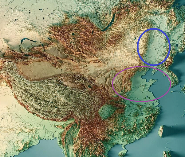
The dialects in the North are more closely related to each other because travel was a lot easier. The topography map below shows mountain elevations in China. Circled in purple is the Central Plains, and circled in blue is the Northeastern Plains.

The presence of plains allows easy travel, which means people interact with each other more, and thus means the spoken tongue has the opportunity to meld together into a common tongue.
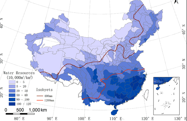
But that’s not all. Southern China is also filled with water – streams, lakes, and rivers. The map below shows the water resource distribution in China. While water is indeed a resource, it also presents a barrier, especially when combined with the mountains shown in the topography map before.
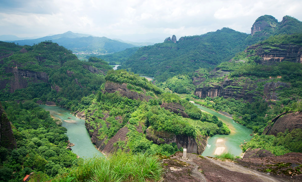
This is most exemplified by the province of Fujian, which boasts 12 major dialects, spread among the four dialect families of Wu, Min, Hakka, and Gan.
Just look at the image below of Fujian. Sure, it looks beautiful, and well worth a vacation, but imagine living in this hellhole. You’re completely isolated even from a village three mountains over. Dialects form, and remain, due to poverty and isolation. Fujian was the posterchild of backwardness and poverty prior to the Communist liberation, and its development only started once the fascist threat was eliminated around the early 1990s.
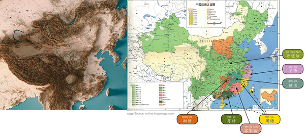
As a result, notice how the dialect map of Chinese closely resembles that of its topography.